If you read nothing else
- The Maragua Crater was not formed by volcanic activity. It was formed by thousands of years of erosion.[1]
- Sucre sits at around 2,810 metres above sea level, and Maragua on the trek is listed at 3,100 metres.[2][3]
- The hike follows a pre-Hispanic camino known as the Inca trail of Chataquila, downhill for 6km.[4]
- From Maragua the walk continues down to Niñu Mayu, where around 100 dinosaur footprints can be found.[4]
- May to October is ideal for Sucre and the trekking regions of the Bolivian Andes, with clear skies and mild conditions.[5]
- Top choice Crater and Inca trails from US$95 Duration10 hours[6]Rating4.76 from 100 reviews[6]Guide languagesSpanish, English[6]Free cancellationUp to 24 hours before[6] Check availability
- Sunrise, crater, cave art from US$106 Duration10 hours[7]Rating4.66 from 16 reviews[7]Guide languagesEnglish, Spanish[7]Free cancellationUp to 24 hours before[7] See this tour
- Two days in the crater from US$125 Duration2 days[8]Rating4.95 from 12 reviews[8]Guide languagesEnglish, Spanish[8]Free cancellationUp to 24 hours before[8] See this tour
The Andes (La Paz, Sucre, Potosí) : May to October is ideal for visiting Bolivia’s high-altitude cities and trekking regions, with clear skies and mild conditions.
Is the crater trek worth a day of your trip?
Read before booking
- Choose a date in the May to October window if you can.[5]
- Pack layers: strong midday sun, cooler shade lower in the valley.
- Sun cream, a hat and a refillable water bottle.
- Allow a day or two in Sucre to get used to the altitude.
What the Maragua Crater really is
The Maragua Crater is not volcanic. It was formed by thousands of years of erosion.[1] That is the most useful thing to know before you walk into it. It changes how you read the landscape: stacked bands of soft sediment instead of dark lava, rounded gullies instead of a sharp cone, and a floor of fields and orchards rather than bare rock. In Spanish it is written as crater de Maragua, Sucre, Bolivia, and the name covers both the basin and the village on its floor.
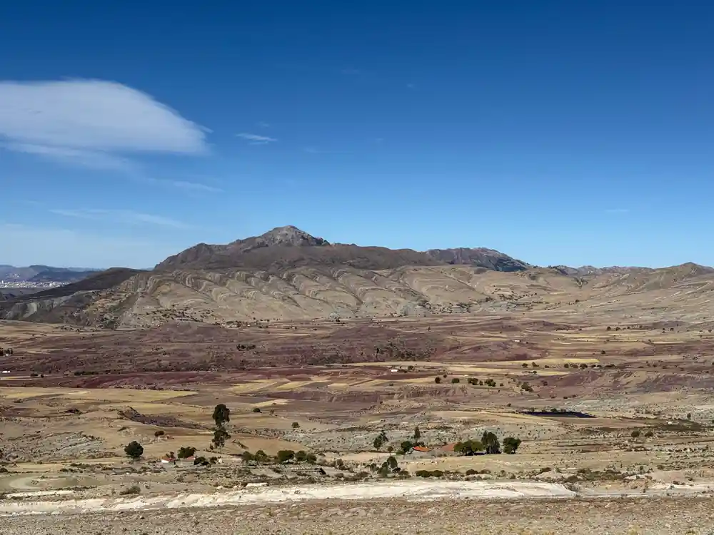
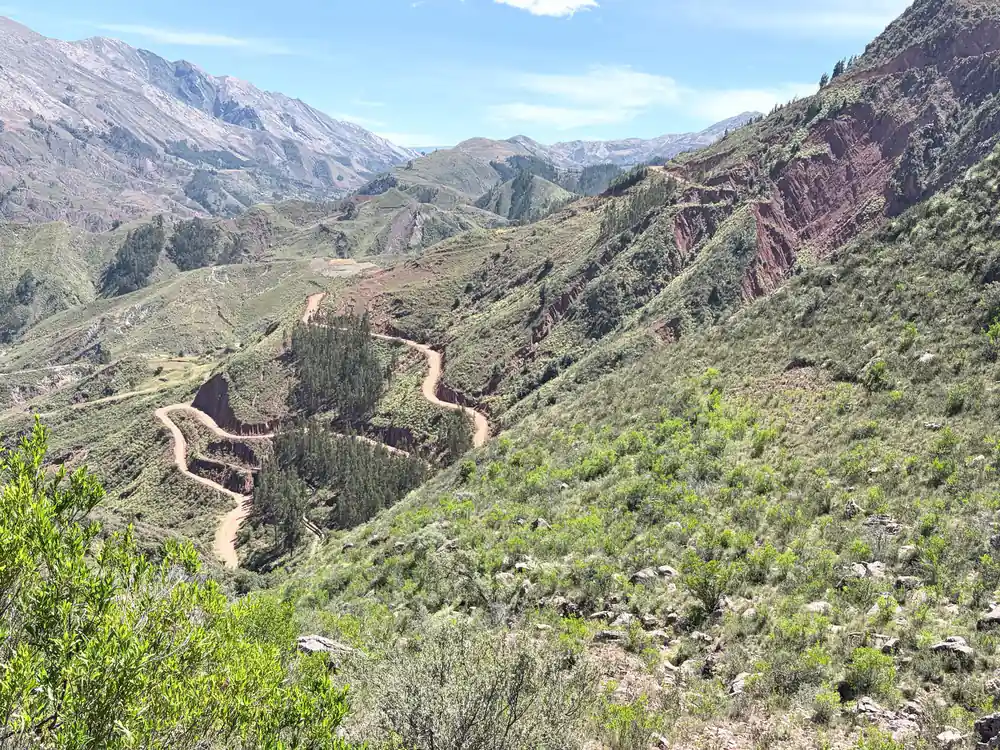
From the rim the shape reads clearly. The walls curve around a wide bowl and the layers inside them run at an angle, so the crater looks like a slice through a stack of old pages. Villagers and guides call it a crater and the name has stuck. Nothing here came out of a vent; water did the work over a very long time, following soft beds and natural cracks down through the rock until a hollow opened up.
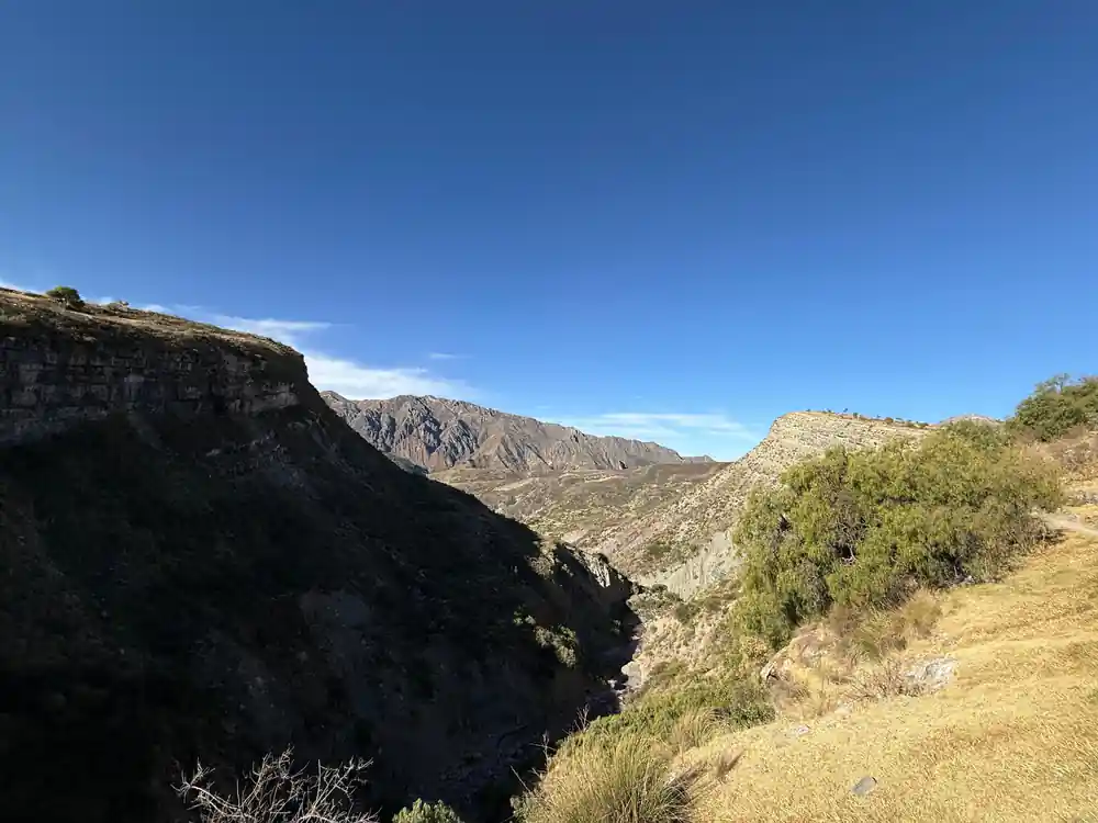
The name causes most of the confusion. People arrive expecting a volcanic cone and find a green basin with a village in it, walls of layered rock on every side and a track winding along the floor. It is a good walk in either direction, and the usual route drops in from Chataquila on the old trail and leaves by vehicle at the end of the day.
Folding first, then erosion
Before there was anything to erode, there was sediment. Sand, silt and lime settled in wide flat sheets, probably on a shallow sea floor or a broad floodplain, and over immense stretches of time they hardened into rock. Then the ground was squeezed and lifted, and the Andean uplift folded those flat sheets and tipped them up on their edges. The steep angle of the strata you walk past is a record of pressure applied long before anyone thought of walking here.
Erosion came second, and it came slowly. Rain and runoff found the weak points, worked along the joints and carried loosened material away downhill. Drainage cut deeper, the valley widened and a bowl took shape. The crater is less a hole punched into the landscape than a hollow carved out of it, with harder beds left standing as ribs and ledges while softer rock crumbled into slopes and dust.
What you walk through, then, is the inside of a fold, opened up. The rock was laid flat, compressed, bent and lifted, and then cut into by water working from above. Each stage left something visible: the banding, the angle of the beds, the smooth curves of the gullies and the stubborn edges of the layers that held out longest.
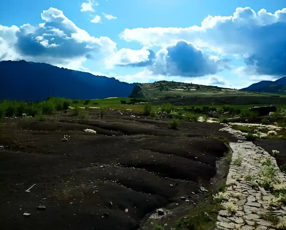
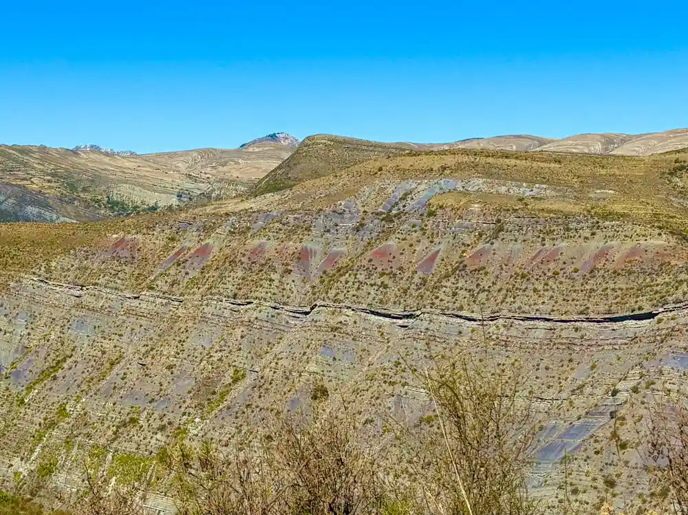
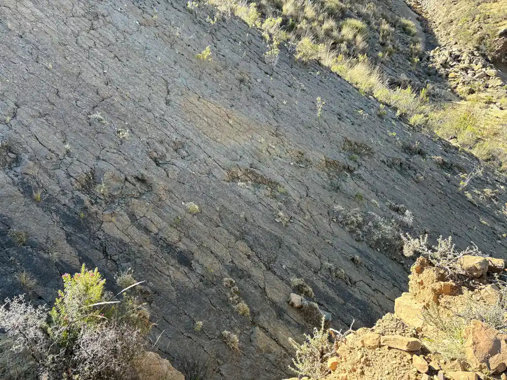
Layered beds tilt through the crater walls above the valley road.
Why the beds stand on end
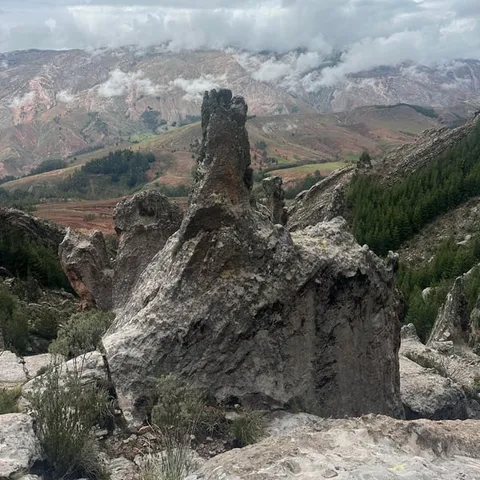
Walk the trail and you pass tilted beds that look ready to topple. They are the same layers that were once horizontal, now standing at a steep angle. Different beds resist weather in different ways: some are hard and stick out as fins and shelves, others break down into slopes and scree. The striped, broken texture in the photographs is the result, a wall of leaning rock with softer material packed between the ribs.
The route crosses the beds rather than following them, cutting across the grain of the rock. You climb over one rib, drop into the gap behind it and cross the next band, and the colours change as you go: dull greys and greens, reds and ochres, pale bands that catch the light. Take your time on this stretch and look up as well as down, since the shape of the whole basin is easier to read from a few steps back.
Photographs tend to flatten all of this. In person the bands wrap around the basin in long curves, and the scale lands when you notice how small the vehicles look on the track below. Give yourself a minute at the top of the descent before you start down.
The walk down the Inca trail
The hike starts just behind a small chapel on the road at Chataquila. From there the route follows a pre-Hispanic camino, also known as the Inca trail of Chataquila, downhill for 6km.[4] In places the surface is original stonework, worn steps and paved sections set into the hillside, and the going is steady rather than steep.
The ride from Sucre to the Chataquila trailhead takes about 1.5 hours.[4] Pickup is included on the 1-day trek, the outing runs about 10 hours and the guides speak Spanish and English.[6] At the bottom of the descent the trail reaches Chaunaca, and from there the route continues toward the crater floor.
The drive out of Sucre is part of the day. You leave the white city and its tiled roofs, climb into open country, and get a first sight of the basin from the rim before the trail starts to drop. The road, the river and the terraces below are usually the first photographs of the trip.
from US$95
A 1-day trek from Sucre into the crater along the Inca trail from Chataquila, with pickup and a live guide in Spanish and English.[6]
Height, pace and the crater floor
Sucre sits at around 2,810 metres above sea level and has daytime highs between 20°C and 23°C year-round.[2] Maragua, on the trek, is listed at 3,100 metres.[3] Those numbers matter less than how you feel on the day. The walking is mostly downhill, but the air is thin, and a slow, steady pace with regular sips of water will serve you better than trying to keep up with anyone else.
Guides run the trek in Spanish and English, and you are picked up in the city before the drive out.[6] Bring layers: the sun is strong in the middle of the day and the shade of the valley can feel cool. A hat, sun cream and a refillable bottle are the basics, and shoes with grip are worth more than anything else in your bag on the stone sections of the old road.
Water is the one thing not to skimp on. Fill a bottle before you leave Sucre and drink more than you think you need; headaches are common in the first days at altitude. Most of the walking here is downhill, which is kind on the lungs and hard on the knees, so a steady pace and a rest at the footprints suits almost everyone.
Dinosaur footprints and the Devil's Throat
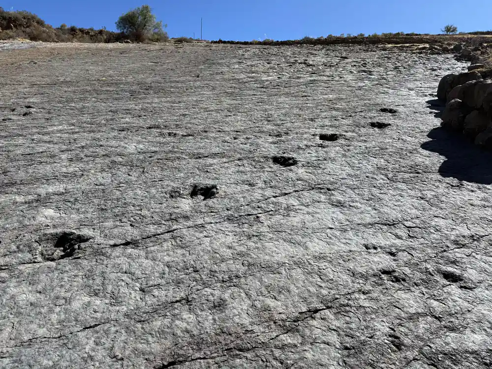
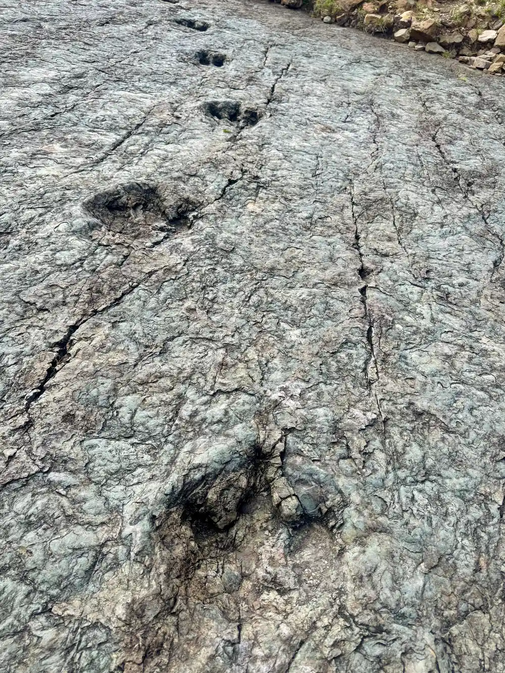
From Maragua the walk continues down to Niñu Mayu, where around 100 dinosaur footprints can be found.[4] They sit in pale rock on a slope, tracks running across the surface, and they are one of the reasons this walk is worth more than a quick photograph.
Not far from the village of Maragua is a set of waterfalls known as La Garganta del Diablo, the Devil's Throat.[1] If your legs and the schedule allow the extra walk, they are a fine place to rest and eat. Ask your guide on the day how the timing looks.
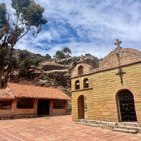
The village sits among worked fields, with a small church and a plaza at its centre. People here farm inside the bowl and have done so for a long time, and the fields, the animals and the tracks between them are part of what makes the crater feel lived in rather than simply scenic.
Who lives inside the crater, and when to go
People farm inside the bowl, and the Jalq'a communities around Maragua are known for their textiles. ASUR began its Indigenous Art Revival Program in 1985 to revive traditional textiles and generate additional income for the Jalq'a and Tarabuco communities.[9] A weaving class or a morning in the textile museum in Sucre pairs well with the trek if you have the time.
May to October is ideal for visiting Sucre and the trekking regions of the Bolivian Andes, with clear skies and mild conditions.[5] Sucre keeps its eternal spring, with daytime highs between 20°C and 23°C year-round.[2] Book your date ahead in that window, give yourself a day or two in the city before you walk, and keep the evening of the trek free.
If you have one full day in Sucre for the outdoors, this trek covers the old road, the crater and the footprints, with pickup in the city at the start and a drop-off at the end. Bring your own water and a hat, allow for the altitude, and the day takes care of itself.
Crater Maragua tour prices from Sucre
What a crater trek from Sucre costs
GetYourGuide from-prices in US dollars:[6][7][8][10]
When to book and when to walk
How the day works
Pickup in Sucre
You are collected in the city and driven out toward the trailhead. The ride to Chataquila takes about 1.5 hours.[4]
Down the old camino
From Chataquila the route follows a pre-Hispanic camino, the Inca trail of Chataquila, downhill for 6km.[4]
Into the crater
The trail reaches Chaunaca and continues into the basin, where the village of Maragua is listed at 3,100 metres.[3]
Dinosaur footprints
Below the village the walk goes on to Niñu Mayu, where around 100 dinosaur footprints can be found.[4]
Back to Sucre
The jeep or SUV returns you to the city at the end of a day of about 10 hours.[6]
Book the 1-day Maragua crater trek from Sucre
from US$95Reserve now & pay later